Day 1
February 2008 and Chicagoland is suffering the heaviest snowfall accumulation in 25 years. Cabin fever is setting in bad and I am spending more time at work than ever. It's time to escape!!!! The wife just spent 6 days down in Florida with her soccer buddies and was planning another major house remodeling project. There were no more excuses and no more reasons not to pack the bags and go.
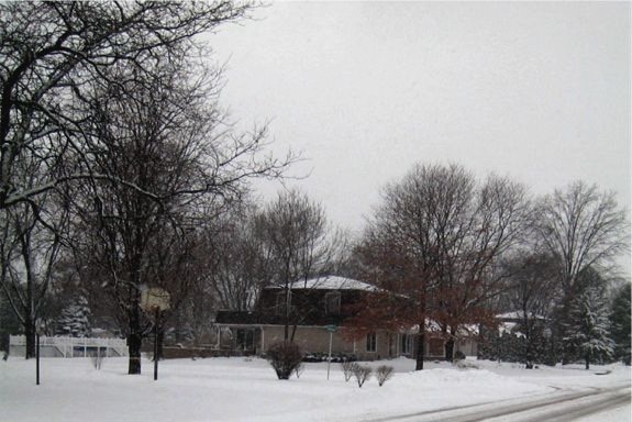
The homestead with a driveway full of snow to shovel before picking up the kids from school , making dinner and going back to work and ...........
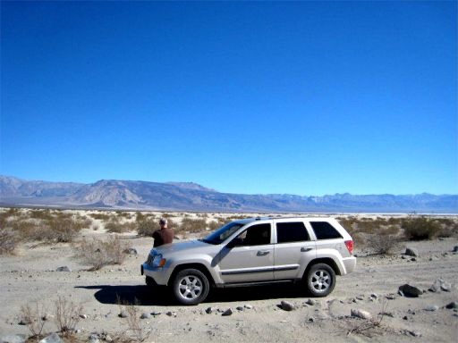
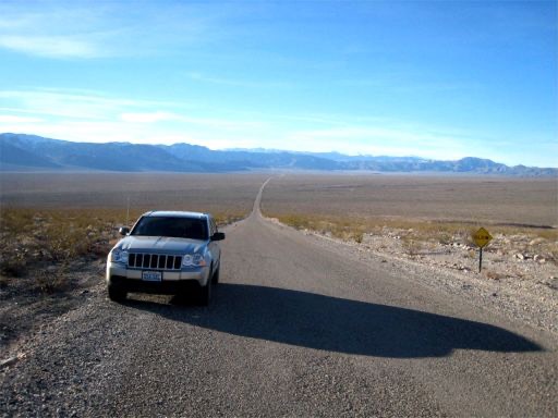
It's Friday 6:30am at Midway Airport and the pilot informs us a computer has malfunctioned and we are shutting down while maintenance brings over a new unit. Five hours later I am in Las Vegas talking to the lost luggage department at McCarran Airport who is trying to console me with a $50.00 lost luggage voucher and promises of delivering the bag if and when they find it. I tell her they can deliver it to Teakettle Junction at 9:00 am the next morning because that is where I intend to be. I give her the GPS coordinates for the remote spot in Death Valley. She is not amused and neither am I. I doubt whether she will be sending me a Christmas card next near. Luckily the bag shows up on the next flight. I arrive at Dollar-A-Day rent a car only to find my 2008 4 door Jeep Wrangler has just been rented to another customer because I was late getting there. There is only one Jeep left, a 2008 Jeep Grand Cherokee Laredo with no low range and according to the warning messages that will beep at me for the next four days, an oil change. I am burning daylight and way behind schedule.
I start to make up time on the beautiful, snowless 75 mph highway to Death Valley. A Nevada Highway Patrol officer flashes his lights at me and gestures to me to slow down. I finally relax now that I have caught my first break of the day. I start to realize today is a good day. No matter what went wrong earlier it still beats being back at the office staring at multiple computer screens.
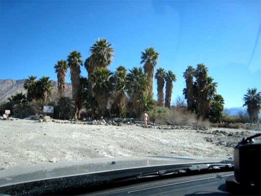
My first day is spent just relaxing on paved roads. There are not too many other tourists, most are foreigners enjoying the week Dollar which brings them to our shores in droves. With so many Japanese tour buses about I write the name Enola Gay in the layer of dust forming on my silver Jeep.
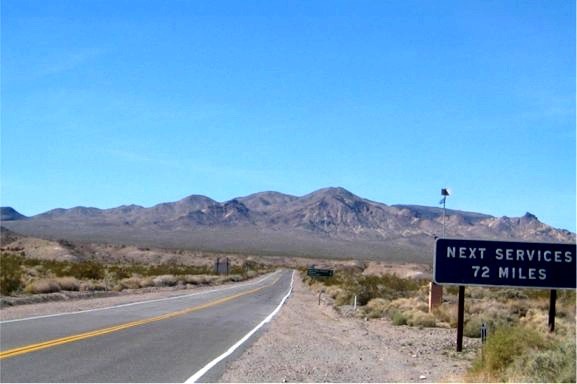
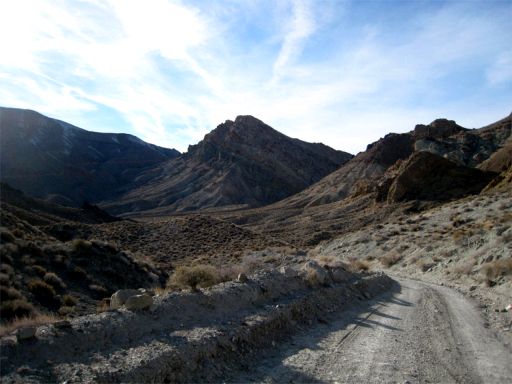
My kind of sign - no services means solitude
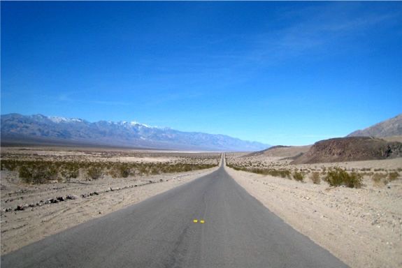
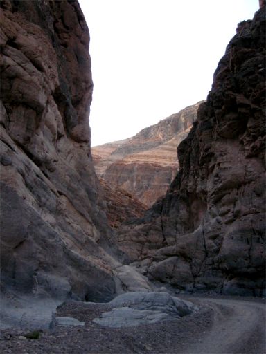
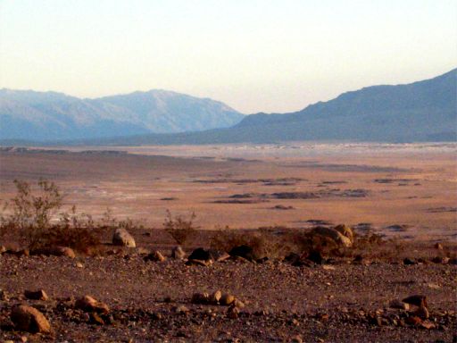
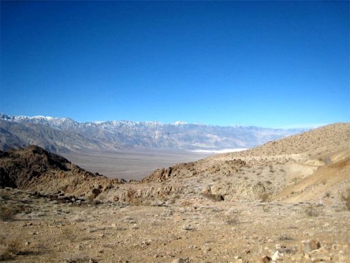
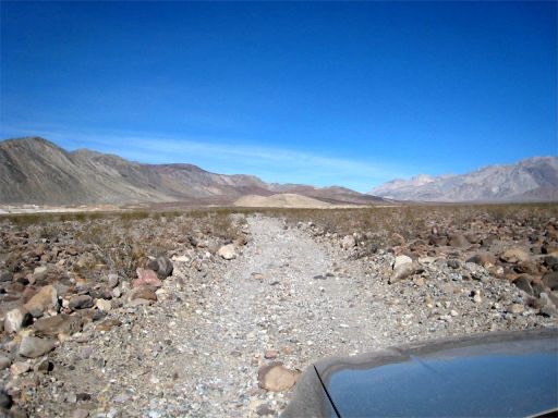
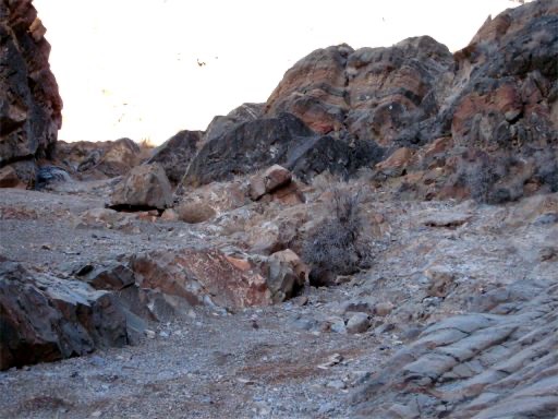
The road to Badwater coming from the south
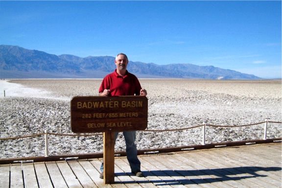
First stop is Badwater, which is a basin noted as the lowest point in North America with an elevation of 282 foot below see level. The site itself consists of a small spring fed pool of water next to the road, however, the accumulated salts of the surrounding basin makes it undrinkable, thus the name "Badwater". My GPS was telling me that I was at -289 feet so something was amiss. I later found out the sign was just for tourists and the lowest point was actually several miles to the west.
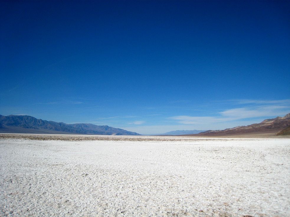
Badwater Basin
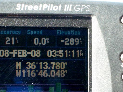
A damn good looking sign Can the GPS be wrong
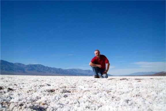
Taking a break after running across the basin to see if was salt all the way across
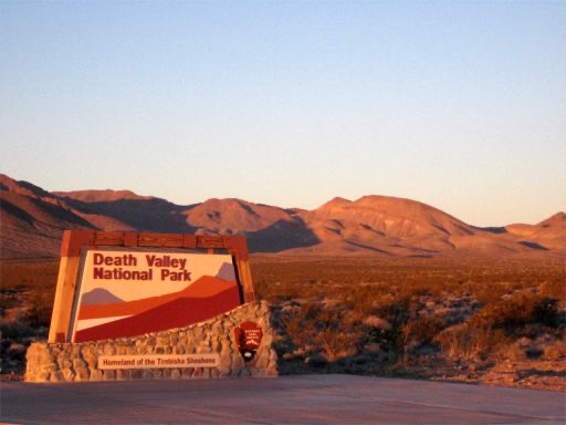
Did you know that Death valley covers an area of 3,367,626.88 acres and was named by some bright spark in 1849 who decided to take a short cut across the valley to get to the California Gold Rush. Only one wagon made it out and as one of the surviving members was leaving turned back and said "Goodbye Death Valley" and the name stuck. In a passionate moment of cigar usage Bill designated the park a wilderness preservation area and put 100 people to work making "No Driving Off Road Signs" and depositing them throughout the park. In fact the signs now out number the cacti plants.
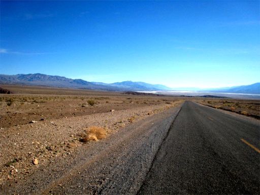
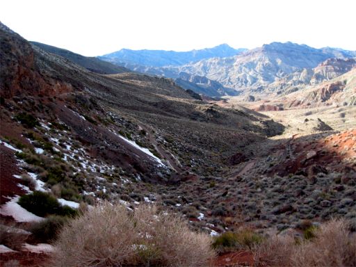
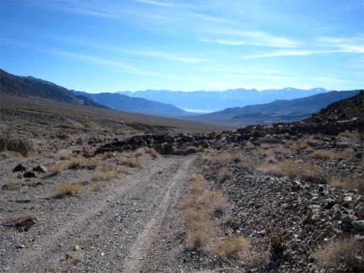
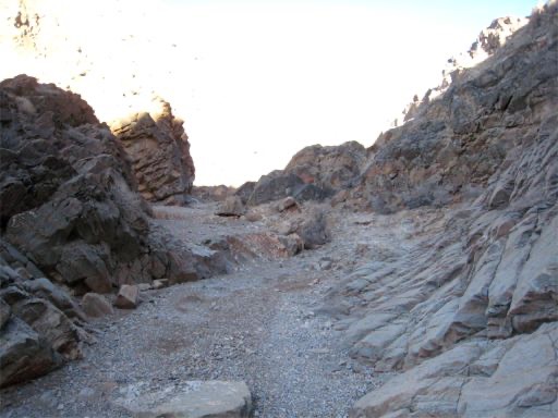
The road looking South back toward Badwater Basin.
As I look back at Badwater Basin I am starting to realize that the Cherokee gets pretty good gas mileage which is a good thing seeing as I have not seen any gas stations since leaving Las Vegas. I intend to drive close to 300 miles this first day and that would have been impossible in the Rubicon unless I carried a lot of extra gas in cans. There was gas to be found at the Furnace Creek Visitor Center but I would rather pee in the tank than pay the $3.90 a gallon for regular that they were demanding.
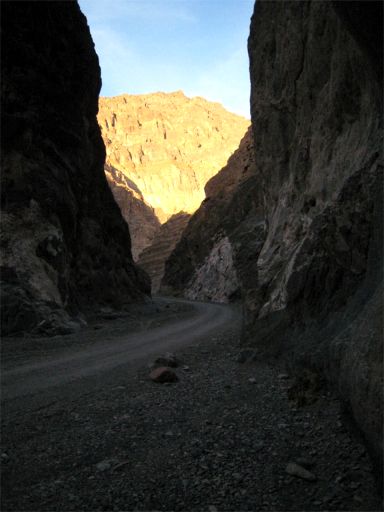
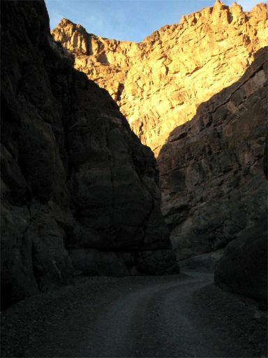
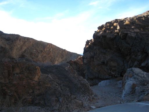
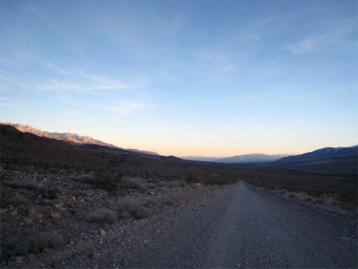
My next item on the Death Valley agenda was Titus Canyon which is described as a one way 26 mile road running from east to west. A 2WD road but high clearance is recommended. Some steep grades and loose gravel. Flash flood danger. Spectacular, narrow, high walled canyon, Mining ruins and North American Petroglyphs but no mention of crazy Californians in rusted out hippy Volkswagen buses and pick up trucks traveling at high speed, in tight formation making sudden abrupt stops.
The sun was starting to go down so photographs would not be very good but I was on a schedule and burning daylight. Two cars started to follow me so I kick up enough dust to make them turn around or just plain stop. Just too much dust to tell. I came across a couple oohing and aahing at a piece of rock but it wasn't Moab so I kept going. Then the VWs!!! I havent seen that many spare wheels on a vehicle in a long time at least not since I saw a Discount Tire delivery truck. I let them go by a couple of times only to find them stopped a little way ahead and then they were off again. A very cool sight indeed but it would pale in comparison to future sights in Death valley.
Titus Canyon is actually a very nice trail. Some nice shelf roads, plenty of packed snow and ice to get your attention and the canyon itself is very long probably around 6 miles. Well worth the trip. The road gets closed in summer because of the heat in the canyon or maybe there are too many VW buses.
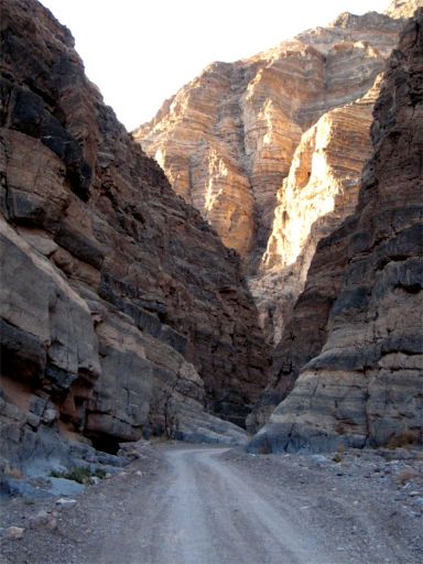
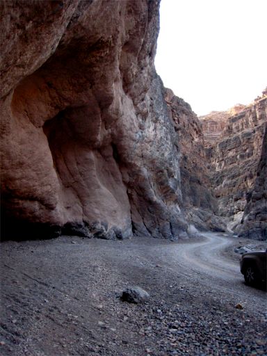
Titus Canyon
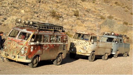
40 years later and still Californicating America
Day 2
I spent the night in Beatty, Nevada which is a small town just outside the park near the entrance to Titus Canyon. It was a hotel/restaurant/gas station/casino. The same people playing the slots when I arrived were still playing them when I left at 6:30 AM the next morning. It's nice to have company on these trips just like it is to have someone to go to the movies with. However, there is something really nice about getting up when you want to, eating when you want to, going anywhere you want to and never having to ask someone else's opinion. I knew this second day was going to be a very long day. It would be another 300 mile trip without any gas stations, food, water or any help. I would climb as high as 6,497 ft and drop down as low as -43 ft below sea level. My gas tank was filled to the brim and the gauge said I had 344 miles until empty. It would be close!!
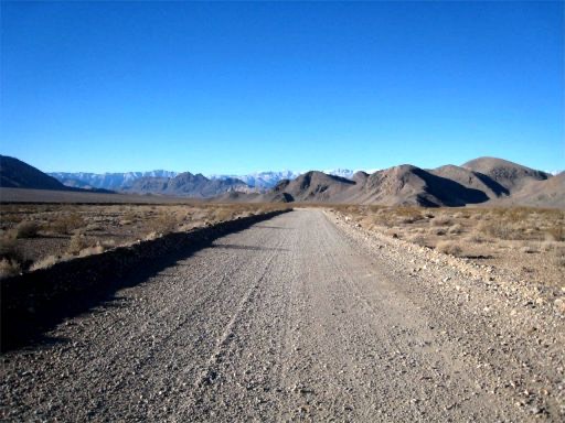
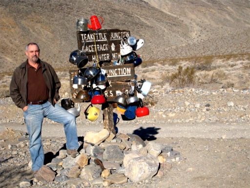
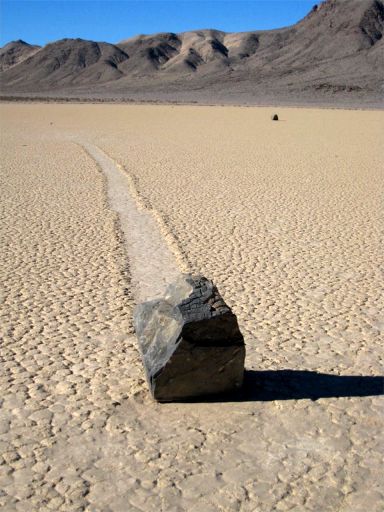
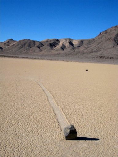
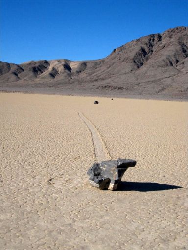
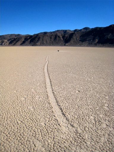
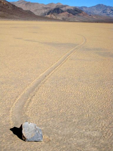
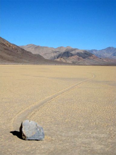
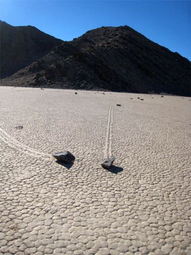
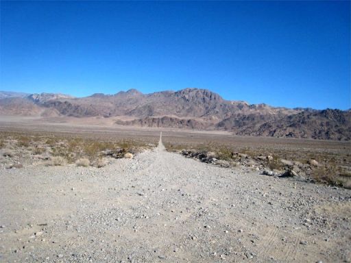
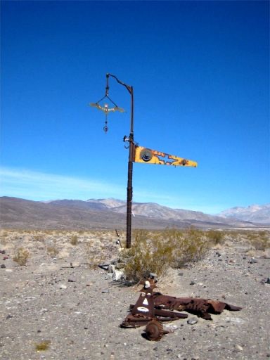
From Beatty to the trailhead of Racetrack Valley Road was 118 miles. The Racetrack Valley Road at that point became a 28 mile rough gravel road. There is nothing really special about this road, you can stop off and check out the Ubehebe Crater and the Little Hebe Crater which basically are just big holes in the earth. I hammered down to get to the Racetrack before the grockels got there. I stopped off at Teakettle Junction for the obligatory photograph.
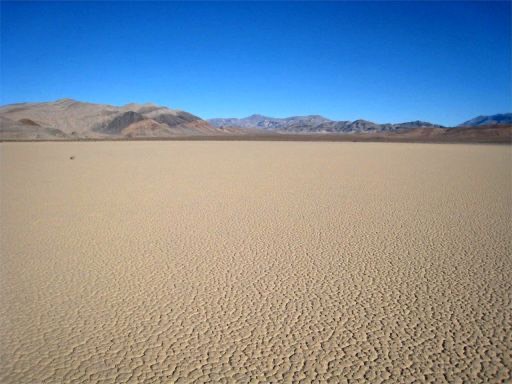
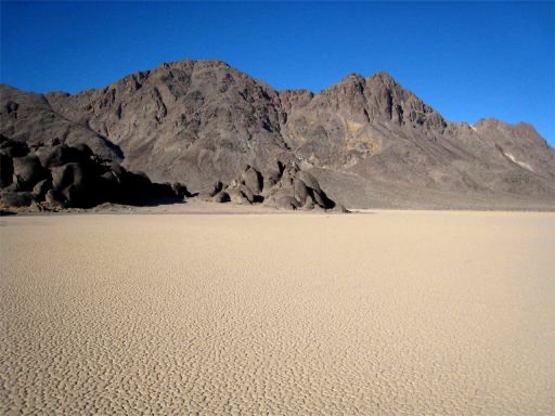
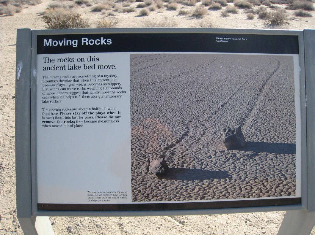
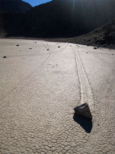
The sign clearly tells people to stay of the Playa when wet and muddy because the footprints last for years. It would also seem to be common sense not to mess with the rocks but would you believe morons have been screwing this area up really badly. Making pretend dinosaur footprints, leaving garbage, moving and even stealing the rocks. I am sure it will not be long before this area is banned to visitors or you have to take special walk ways constructed by the Park to stop the very few stupid idiots from ruining it for everyone else. Still the rocks were pretty cool, the sun was shining, it was 75 degrees and I was not at work and I was totally alone.
Did you ever wonder why it so hot in Death valley. I didn't but I am sure you won't be able to sleep tonight until I give you the answer. Well after an exhaustive study and many thousands of Dollars it was determined one of the reasons is because it is very sunny. It doesn't rain much if at all and it has the highest spot Mount Whiney, just 100 miles from the lowest point in the lower 48. The valley is surrounded by mountains which stops the daytime heat from dissipating at night. The mountains to the West capture storms before they can reach Death Valley so that is why it is extremely dry. There, don't you feel better for knowing that!!.
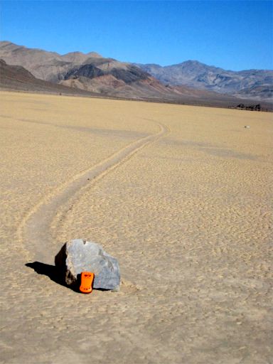
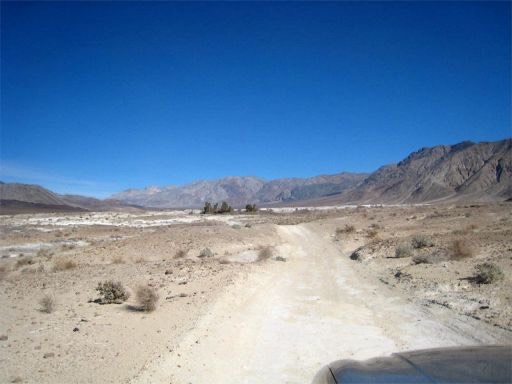
From the Racetrack it was backtrack or take a trail shown on my handy dandy, water proof, tear resistant, all new edition National Geographic Death Valley map. The map did not give it a name although several months later I discovered it was called Lippencott Road. My equally useful Death Valley National Park Map did not even show the trail. Seemed simple enough, just 6.7 miles up the mountain, over the top and back down to the valley floor on the other side. I had Spot my trusty Personal Satellite Messenger which would send out the Calvary, the helicopters and a general mass of search and recue people if I drove off the mountain if I was still able to press the 911 button. Spot is the orange thing resting against a rock in one of the above pictures. It's a handy thing to have. The wife insisted I take it so that she would not have to wait seven years to collect the insurance money. She wanted to know where this body was at all times. No Steve Fossett for my wife. Go tohttp://www.findmespot.com/ to check it out.
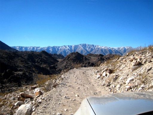
No sooner had I entered the trail I realized this might be too much for this low riding Cherokee. Then there were the signs, like high clearance 4WD only, dangerous shelf roads maybe washed out in winter, all vehicles must have snow chains, no help for next 80 miles, experienced four wheel drivers only. The trouble is there was nowhere to turn round. I was immediately on a very narrow, very bumpy shelf road. It was about a mile before there was anywhere to pass let alone turn around so it was up, up and away. The 6.7 miles took about 90 minutes and really wasn't that bad. There were a few moments of breath holding where the road was washed out and I couldn't see the back wheels. The Cherokee is a long vehicle and I am used to my Rubicon and being to able to look over the side and see what I'm doing or being able to see 3 tires in my Willys.
(
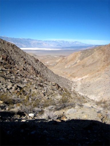
The start of the unknown trail from the Racetrack to the Saline Valley Road.My target is the salt lake about 20 miles distant.
Looking back at the mountain just traversed.
Not sure what is going on here. Maybe peeing, maybe just thinking about work, maybe just resting and taking in the view.
Another weird sign in the desert. This one telling visitors that you are on the Bat Rock Road
Heading toward the Lower Warm Springs and the Upper Warm Springs.
Needless to say to see this old guy, buck naked except a nice hat and a pair of boots was quite unexpected. I let him get out of sight and went over to take a look at the oasis. Low and behold there was another old naked guy reading a newspaper and a couple of others sitting in the spring. I left quite quickly.
I then went on up the trail to the Upper Springs only to see more old guys, one of which hopped out of the hot spring tub to show she was a woman. (I think). There were about a dozen campers at the springs including a well equipped Unimog from The Netherlands. I just kept on going!!
The next 25 miles plus were on a really rough trail. Really too much for the Cherokee but there was no turning back. A fairly well equipped TJ stopped me on the trail and inquired as to where I might be going. The kept repeating - "in that". I just kept on going!!
I didn't see another soul for 25 miles. Crossing Steel Pass took some careful driving with wash outs and big boulders always placed in just the wrong spot in the road. Nothing my Rubicon couldn't handle but again my low rider Cherokee was getting some serious scrapes. Several times it was very hard to determine just where the trail was.
Heading for the notch in the distance mountain
Looking back to the Salt Lake and nearing Steel Pass.
I am quite convinced the Park system makes the beginning of all trails that they really don't want to drive on and rescue people quite difficult for the average SUV. I noticed on the maps that they say that the beginning and end require 4WD and high clearance although the trails are quite doable in 2WD. Dedeckera Canyon is no exception. It was good I had gravity on my side because I do not think the Cherokee would have made it up these ledges. As it is the rockers took a beating.
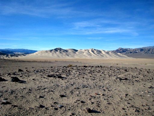
The trail ends at the Eureka Dunes which rise up 700 foot from the valley floor. Climbing to the top just wasn't challenging enough so I just kept on going. I was stopped by some guys in lifted Grand Cherokees who just kept saying "in that". I think it hurt their feelings that such a lowly SUV could make it where they were debating to travel. They told me they were heading for the Springs to join the "Saggies" as the naked old people are known that frequent the Springs. The Springs are apparently drying up more and more each year and the Saggies don't like to share.
Now all I had was about 50 miles of wash board roads. They are just plain uncomfortable and noisy especially when you are tired and hungry with the gas gauge starting to creep near empty. I just don't know why there is a "SLOW" sign here. Maybe they are warning people that there is a big speed bump in the distance or there is a bend in the road somewhere in the next 50 miles. According to the Park Service the highest cause of death in the park is single automobile accidents. I would have thought it would have been heat exhaustion but what do I know.
After I left the park I drove another 80 miles to my hotel for the night. Another 300 mile day ending with the gas tank on fumes.